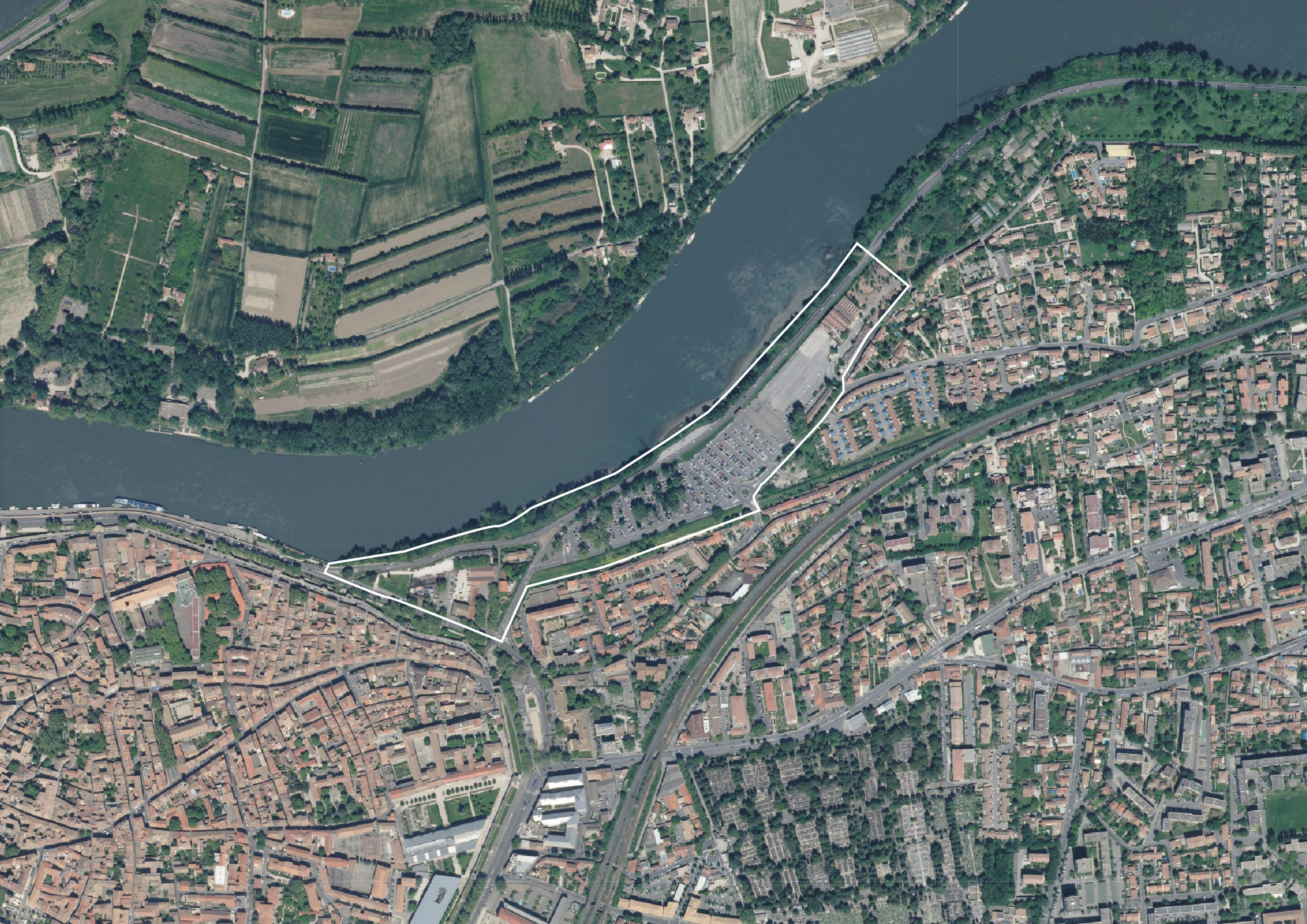
Characterized by a heterogeneous and tenuous urban fabric on its western tip that is a potential flood zone, a large park-and-ride lot on most of the site, and an industrial remnant at its eastern end, the current situation presents a strong potential for regeneration. By 2023, work dedicated to the extension of the Via Rhône and the tramway will make it possible to upgrade the public space of Place St-Lazare, which constitutes the link between the site and the gateway to the city. In this context, the reinforcement of bus lines, the creation of a multistory parking lot on the outskirts, and the activation of a river stop make it possible to envisage a simultaneous evolution of the built environment and mobility in this part of the city. The site is held between the flood-proof Bonaventure dike to the south and the Rhône, as well as the defense dike linked to the Dr. Pons tourist road to the north. The identified area is a particularly strategic space because of its proximity to the inner city and its landscape qualities, which are linked to the lush riparian vegetation of the riverbank as well as to the remarkable trees in the western section of the parking lot.
AV0
Academic year 2021-2022
[photo © Olivier Wavre]

[drawing © LAST]

[drawing © LAST]

[drawing © LAST]

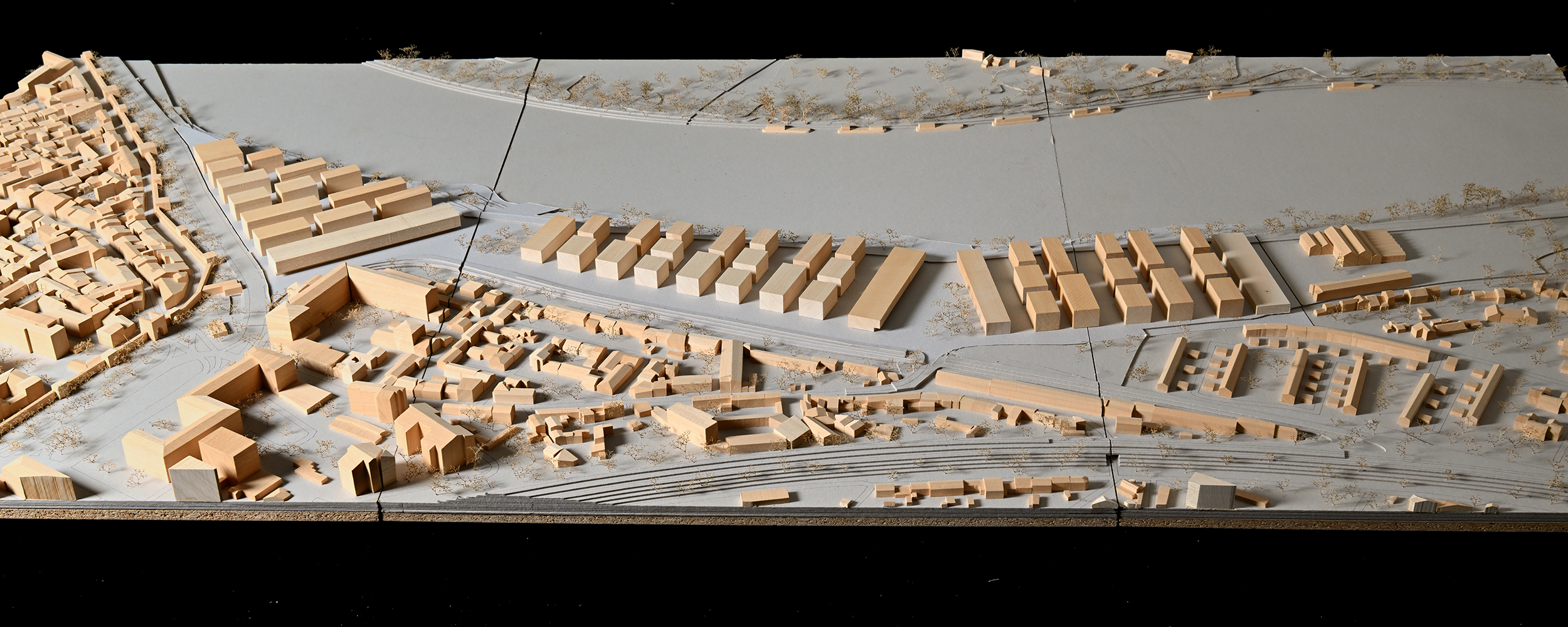
AV1
The project proposes to divert the Dr. Pons tourist road to continue the built fabric of the city of Avignon to the edge of the Rhône and to reinterpret it in the form of a garden city with a strong relationship to the ground. The site is sequenced by three urban parts, between which public spaces in connection with the river slip in, also allowing the installation of a new river stop. Each entity is made up of several small and medium-sized volumes dedicated to different housing typologies: their implantation generates a regular commercial alignment along the south road, while the face on the bank is more informal and porous. Long buildings dedicated to activities border each entity along its east and west sides, thus providing a frontage to the adjoining public space. The industrial remains are maintained and enhanced, thus enclosing the proposed urban system. With an urban form that unites the existing city and the new neighborhood, this project-based vision requalifies the banks of the Rhône through two esplanades, the main river public spaces of the project.
Project based on the work of the following students: Feruz Debrom Gebremedhin, Miyabi Ito
The prospective attitude weaves sequenced links with the river’s landscape space. It translates into an urban form and an urban structure that are part of a logic of extension of the existing built fabric of the city.
[photo © Olivier Wavre]
[drawing © LAST]

[drawing © LAST]

[drawing © LAST]
[drawing © LAST]

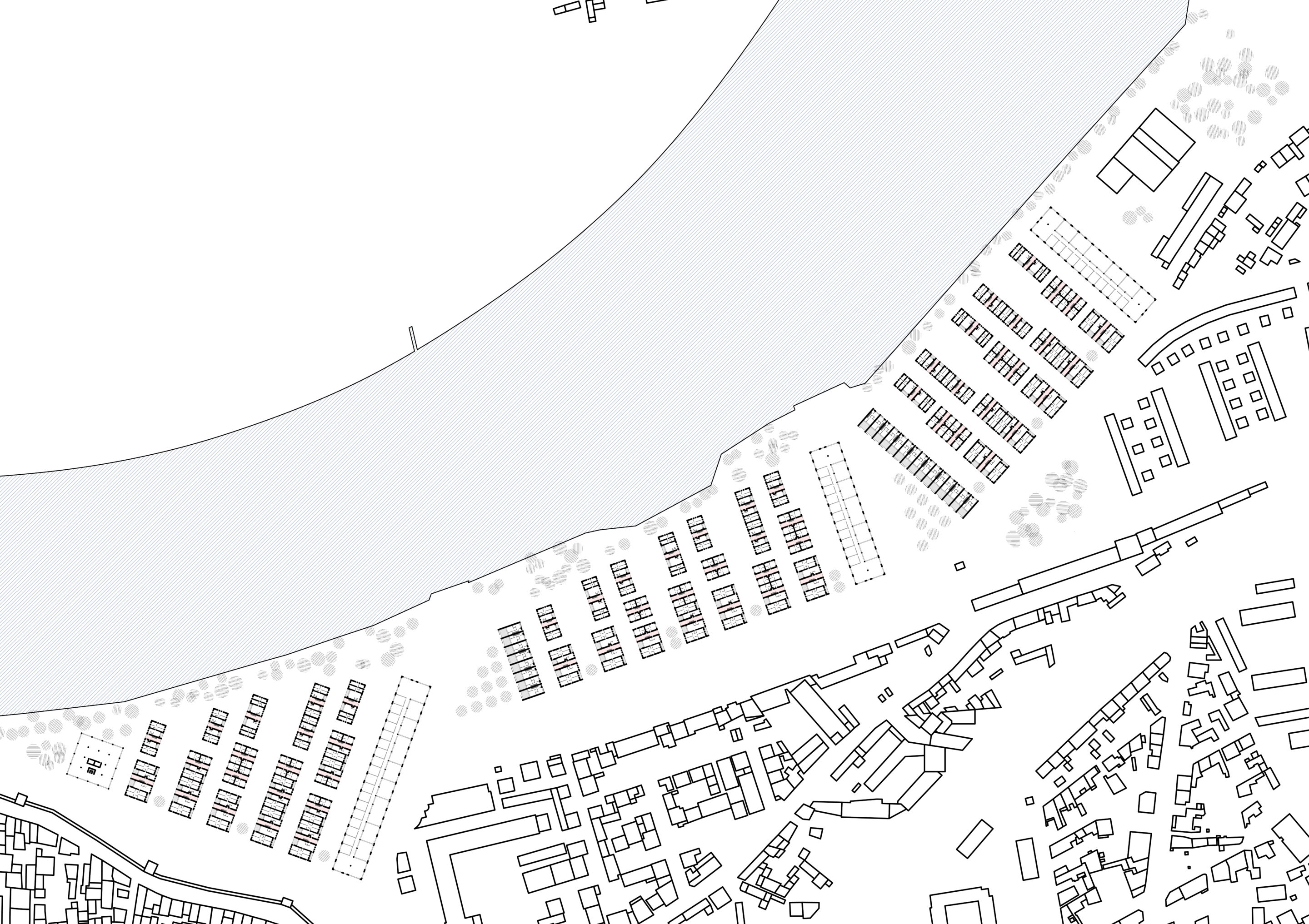
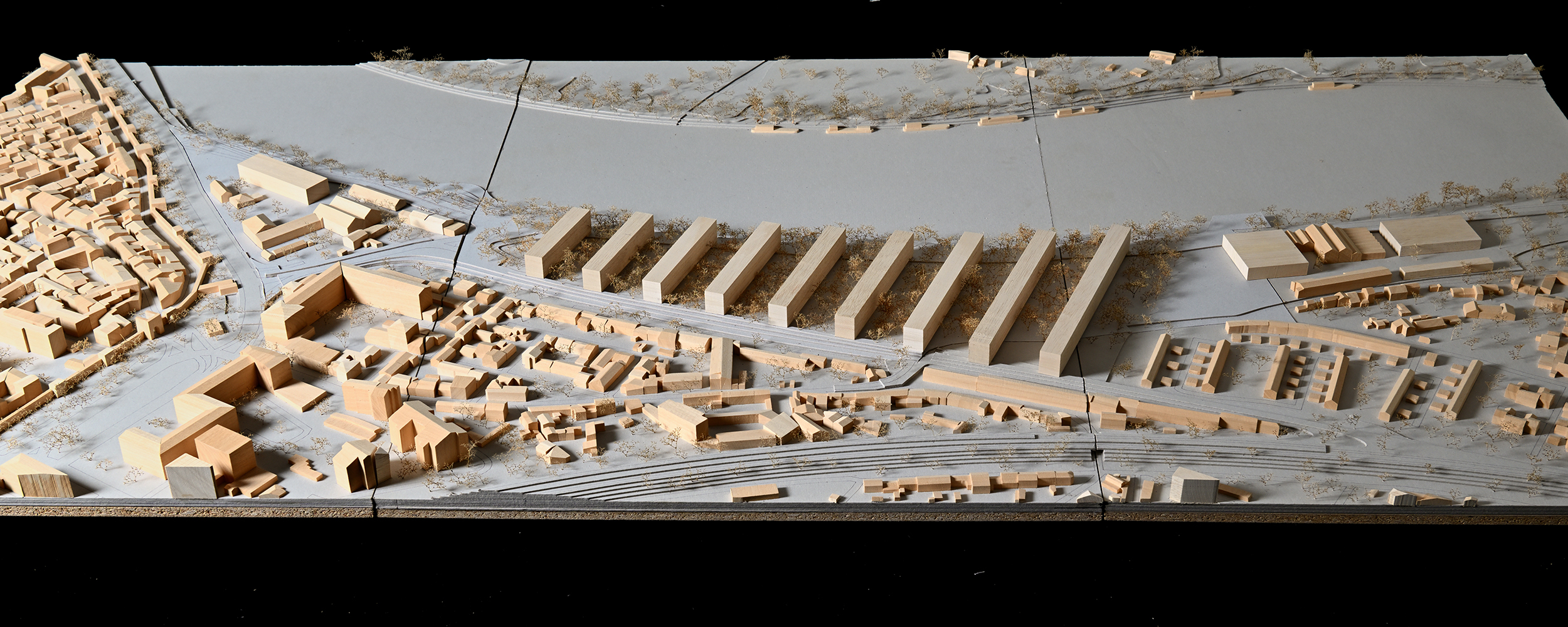
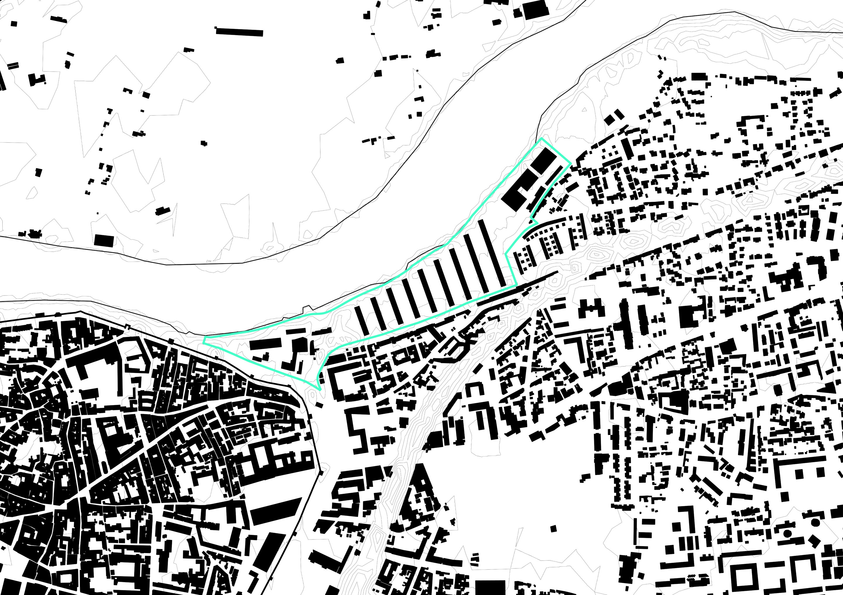
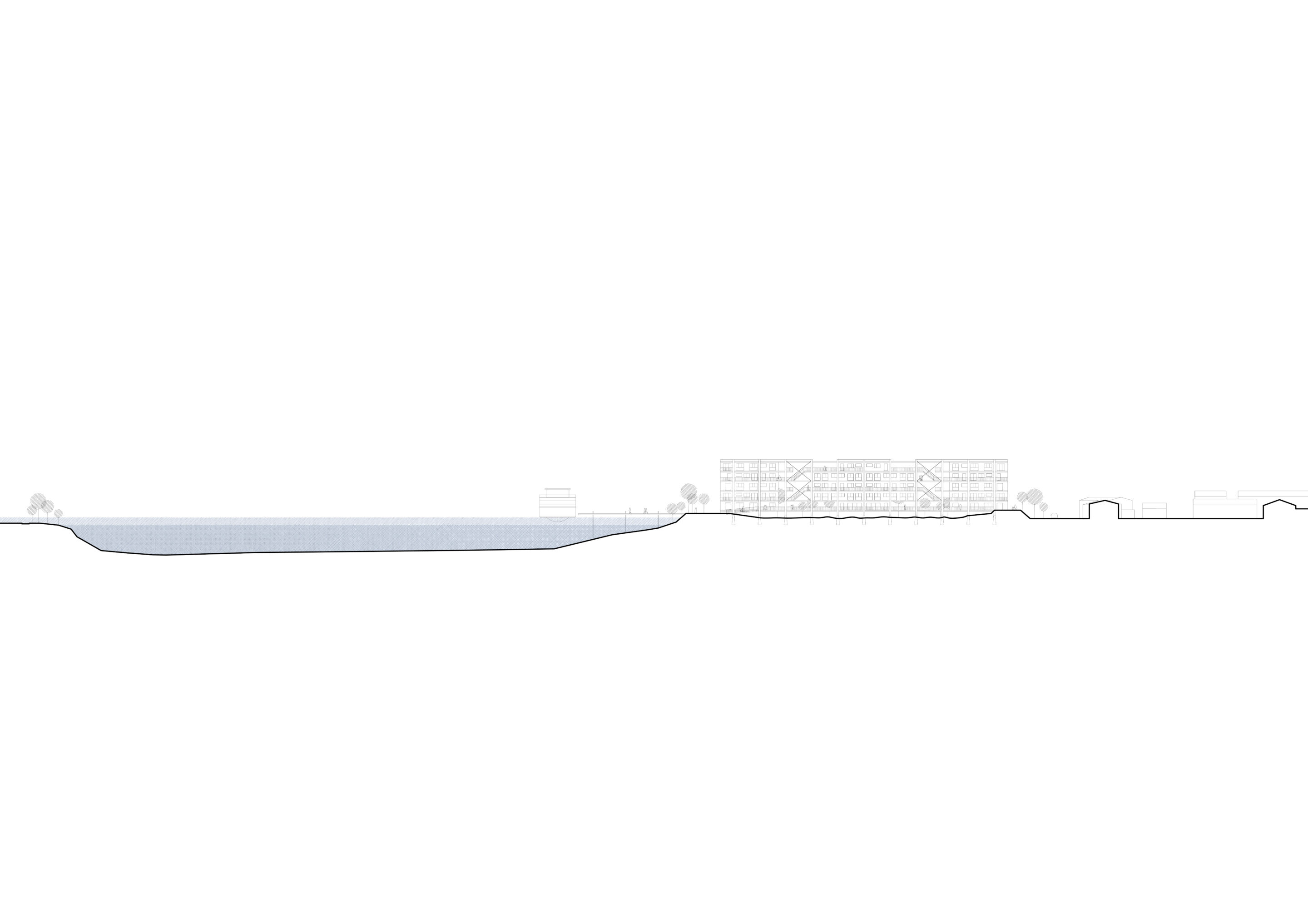
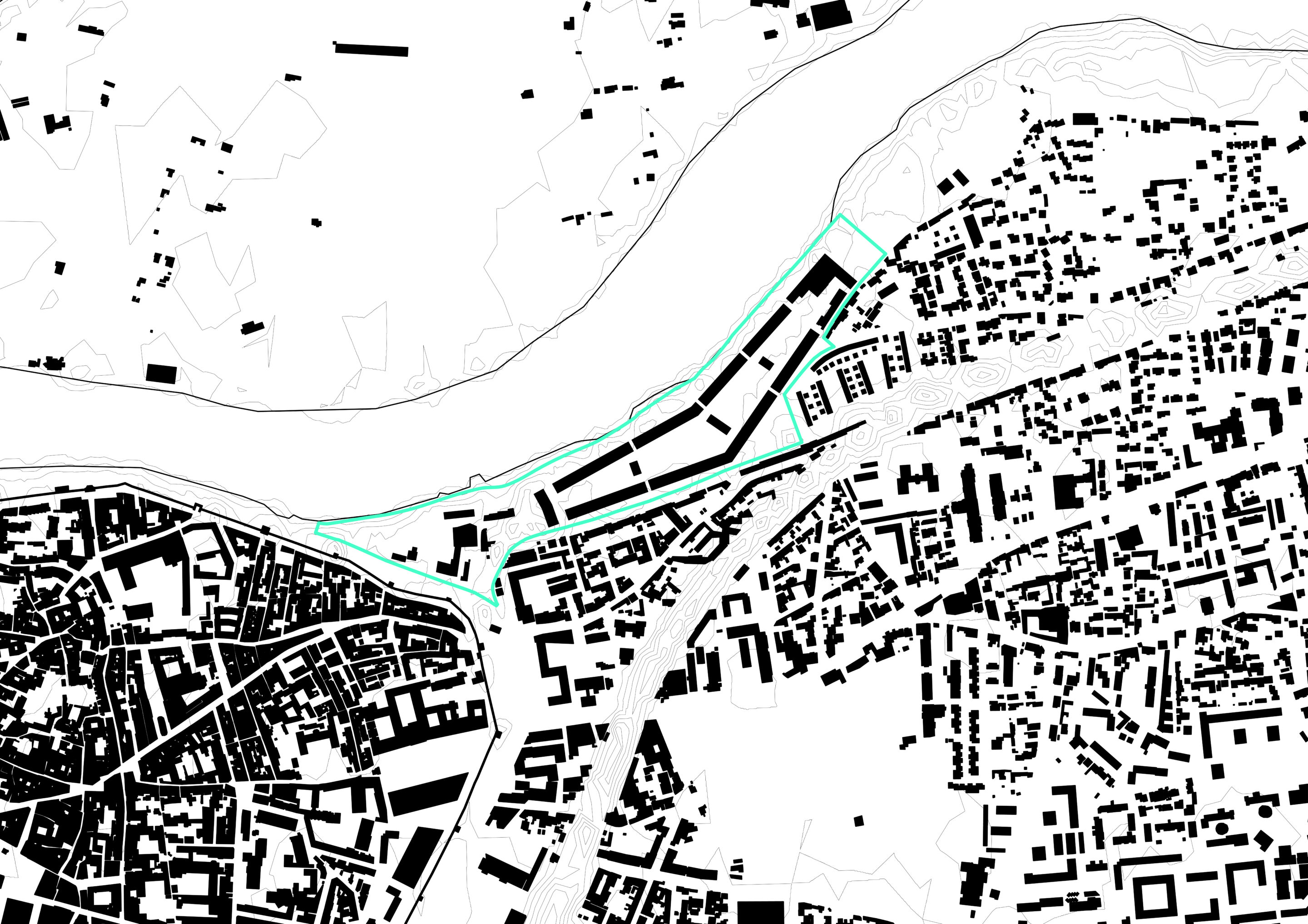
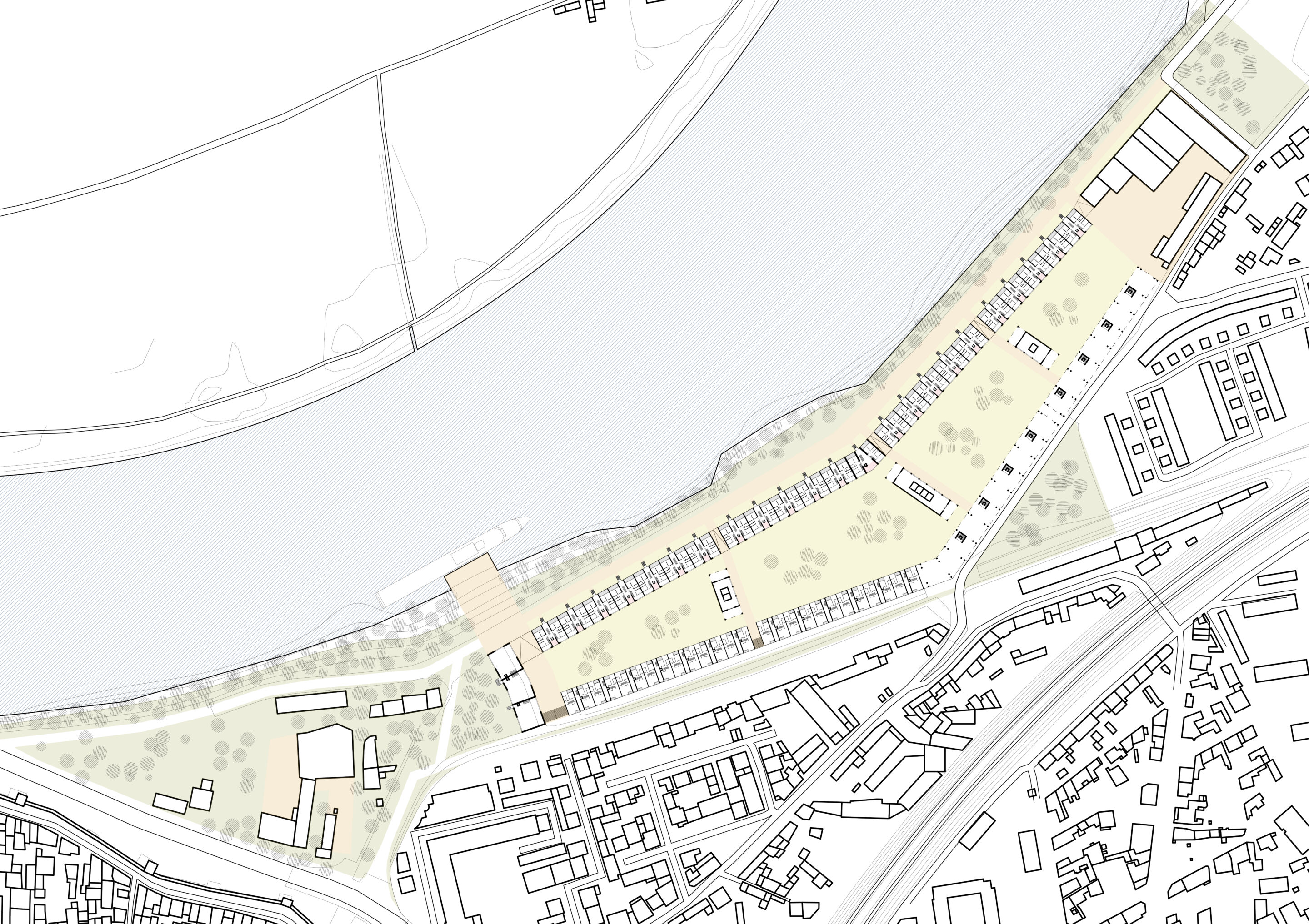
AV2
The project proposes to divert the Dr. Pons tourist road in order to install a series of elongated buildings perpendicular to the Rhône, leaning on the two existing dikes. The western tip of the site preserves the existing buildings and integrates a new volume dedicated to activities. To the east, the industrial remains are maintained, and rehabilitated, and new volumes are added, generating a cultural center dedicated to the performing arts as well as a river stop. The nine slender bars, distributed by alternating east and west side exterior walkways, contain a rich typological variation and are built on stilts. The ground, thus freed and inaccessible to the public, can begin remediation by phyto-purification and welcome the rise of the groundwater. Through a built fabric intersecting different programs and morphologies, this project-based vision transforms the relationship to water. The long buildings and their flooded park, the main river public space of the project, create a new inhabited landscape.
Project based on the work of the following students: Charline Hugues, Hiba Znaidi
The prospective attitude orients and opens up the built fabric of the existing city towards the river. It results in an urban form that alternates between concentrated built spaces and unbuilt public spaces.
[photo © Olivier Wavre]
[drawing © LAST]
[drawing © LAST]

[drawing © LAST]

[drawing © LAST]
AV3
The project proposes to divert the Dr. Pons Tourist Route to install a continuous built entity on the eastern portion of the site while the western tip of the site is maintained as is. A large articulated and permeable block leans against the two existing dikes to the north and south while integrating and enlarging by new volumes the industrial remains. The planted courtyard within the block, dedicated to the residents, is punctuated by three community pavilions. The ground floors and upper levels are dedicated to housing, except for the eastern section on the city side, which is on stilts and reserved for activities. The western end of the long urban form is a slightly lower volume, addressing both the park and the courtyard and interacting with the new river stop. Through a built fabric including the different programs in a unitary urban gesture, this project-based vision renews the relationship with the Rhône: its left bank hosts an important urban bank, the main river public space of the project.
Project based on the work of the following students: Loïse Boulnoix, Valentina Takatch
The prospective attitude deploys a river frontage that is permeable to the built fabric of the existing city. It translates into a large-scale urban form that enters in dialogue with the larger landscape while offering a vast public space at the water’s edge.
[photo © Olivier Wavre]

[drawing © LAST]
[drawing © LAST]
[drawing © LAST]

[drawing © LAST]
