Avignon
The 11-hectare site, mainly housing a 1,600-space park-and-ride facility, is located northeast of the city center of Avignon, on the left bank of the Rhône. A stone's throw from the ramparts of the Cité des Papes, this sector constitutes a particularly strategic space for imagining new links between the city and its river. Simultaneously characterized by strong constraints and genuine landscape qualities, the site has the potential to be transformed in a perspective of significant development of sustainable mobility and the public transport network, especially through the implementation of a new streetcar line and a river shuttle, the reinforcement of bus lines, and the creation of park-and-ride facilities in the periphery. In the context of the energy transition, the research aims to explore through the architectural project the multiple challenges and potentialities of the site reconversion into a mixed-use neighborhood. At the programmatic level, the visions are based on the prospective principle of a certain mix of housing and activities, with increased attention paid to the issue of housing in an urban environment. The process includes relevant reflections on the creation of a cultural center dedicated to the performing arts - which is part of the dynamics of the famous Festival d’Avignon and the action plan "Avignon, Terre de culture 2025" - as well as the development of a network of public spaces considering the unique characteristics of the site.
+ INFOS
INFOS X
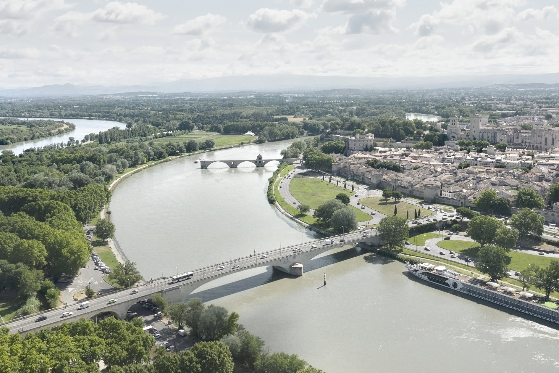
Aerial view of the Rhône in Avignon: to the northeast of the old city, contained between the ramparts and a large park in the making, which harbors the remains of a spinning mill, the study site is cut off from the river by a busy road infrastructure (Route Touristique du Dr. Pons).
[photo © Nicolas Sedlatchek]
[photo © Nicolas Sedlatchek]
+ INFOS
INFOS X
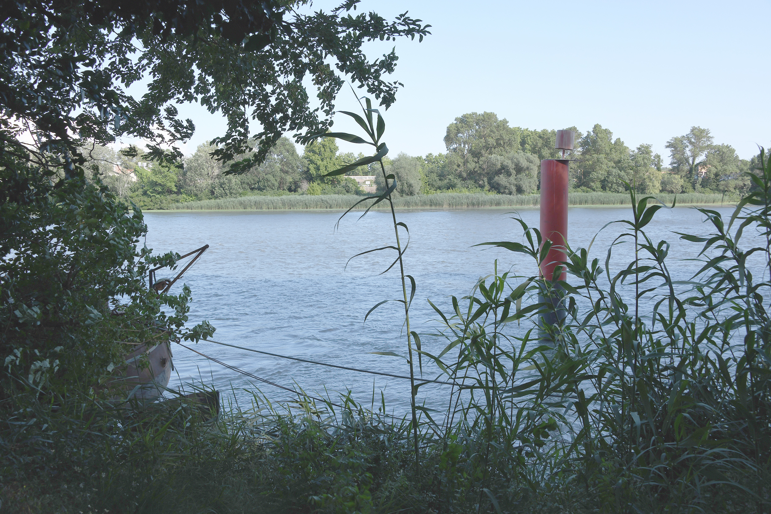
View of the study site in Avignon: a lush riparian zone forms a dense vegetation filter between the study site and the river. Houseboats line the opposite bank of the Rhône, which is equally dense in terms of greenery.
[photo © LAST]
[photo © LAST]
+ INFOS
INFOS X
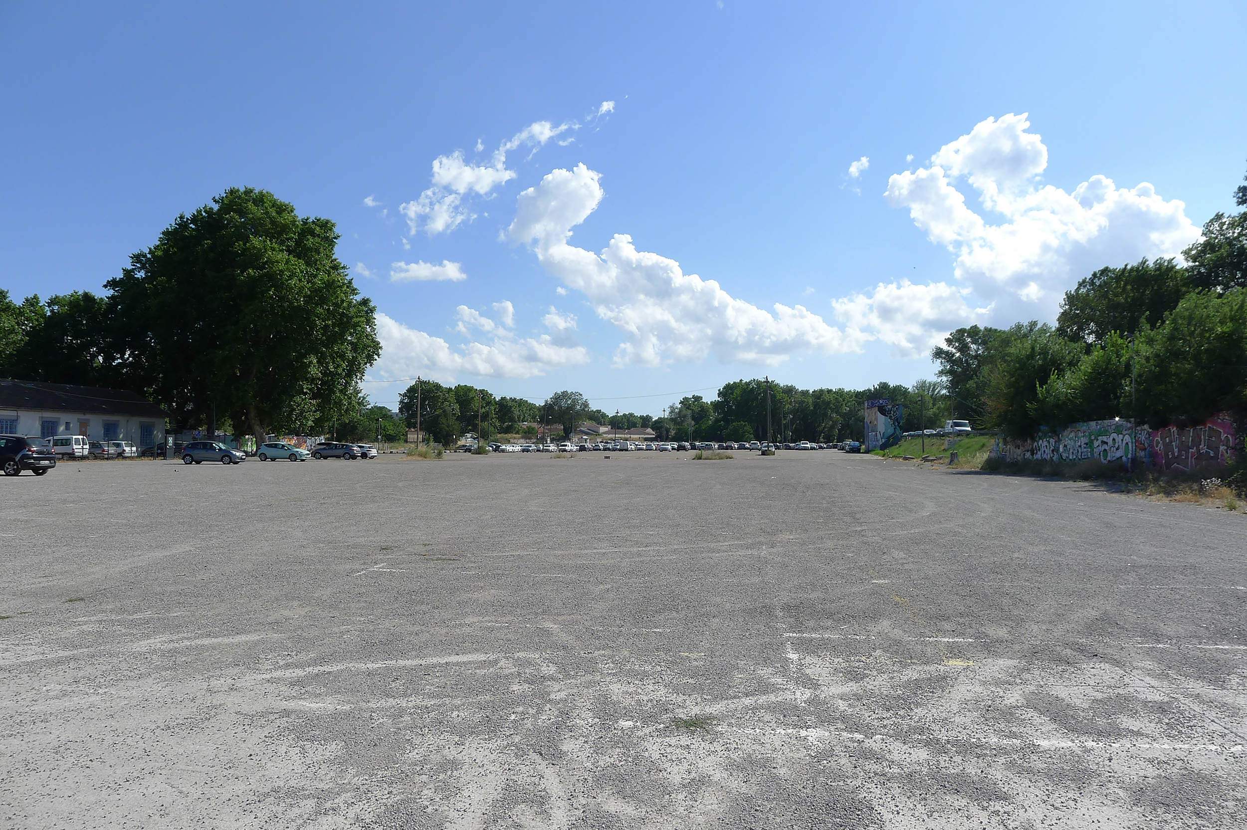
View of the study site in Avignon: a huge mineral esplanade, the Parking des Italiens has 1,600 spaces, and a shuttle bus makes it easy to reach the city center.
[photo © LAST]
[photo © LAST]
+ INFOS
INFOS X
View of the study site in Avignon: in the western section of the Parking des Italiens, remarkable trees deserve to be preserved and highlighted.
[photo © LAST]
[photo © LAST]

+ INFOS
INFOS X
View of the study site in Avignon: the city is mainly known for the Palais des Papes. Thanks to its strategic location overhanging the river, the palace was connected to the north of Europe via the Rhône-Saône navigable axis, dominated the territory and was visible at a great distance, and sheltered from recurrent floods. The city of Avignon was naturally built around the palace, encircled by its 4km long ramparts, flanked by 39 towers, and pierced by 7 doors. The space of the former moat is nowadays filled in and mainly developed for cars. The strong delineation of the built fabric between the inner and outer city is part of Avignon’s urban landscape.
[photo © LAST]
[photo © LAST]
+ INFOS
INFOS X
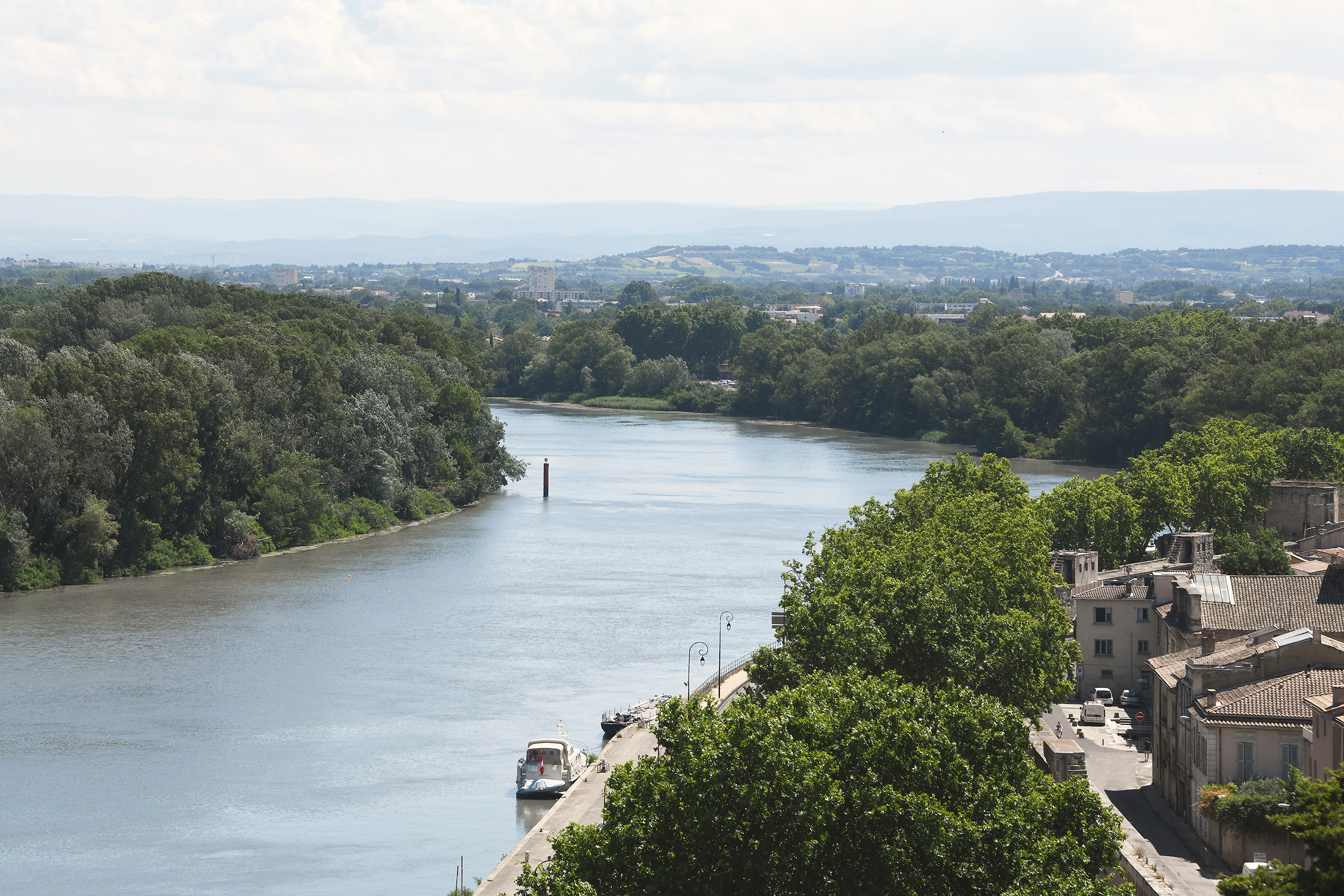
View of the study site in Avignon: the succession of protection strategies against the Rhône floods explains the recessed condition of the parking lot, between the Route Touristique du Dr Pons to the north and the Digue Bonaventure to the south. Conversely, the western tip of the study site remains a flood zone.
[photo © LAST]
[photo © LAST]

+ INFOS
INFOS X
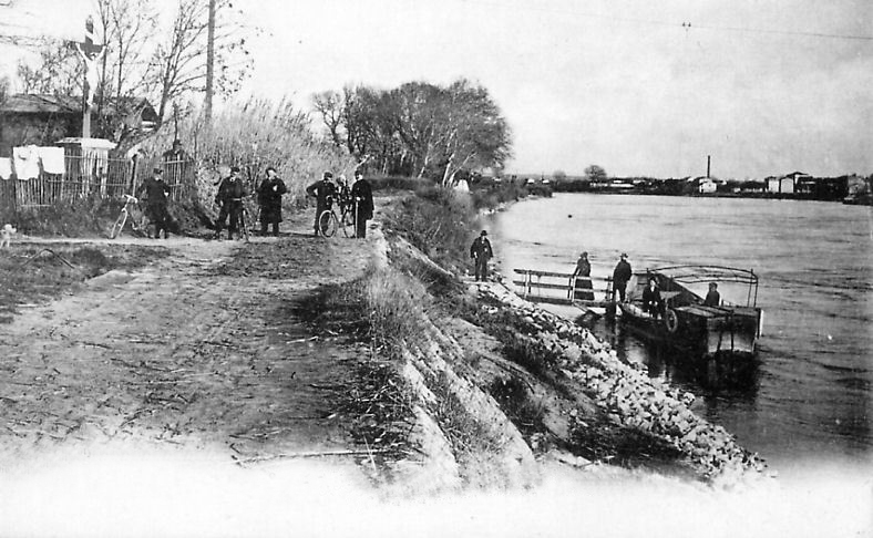
Bac à traille, 1910: following the same route as in the past, a shuttle boat still makes it possible to cross the Rhône, from the Quai de la Ligne at the foot of the Rocher des Doms to the île de la Barthelasse.
[geneanet.org]
[geneanet.org]
+ INFOS
INFOS X
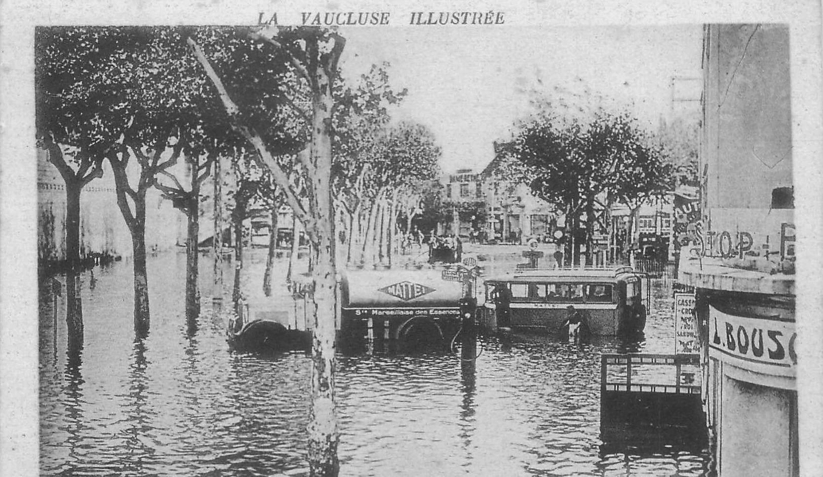
Flood of 1935, Boulevard Saint Michel: in the context of the Rhône floods, the île de la Barthelasse, an agricultural and floodable territory, has always contributed to the protection of Avignon's city center.
[geneanet.org]
[geneanet.org]
+ INFOS
INFOS X
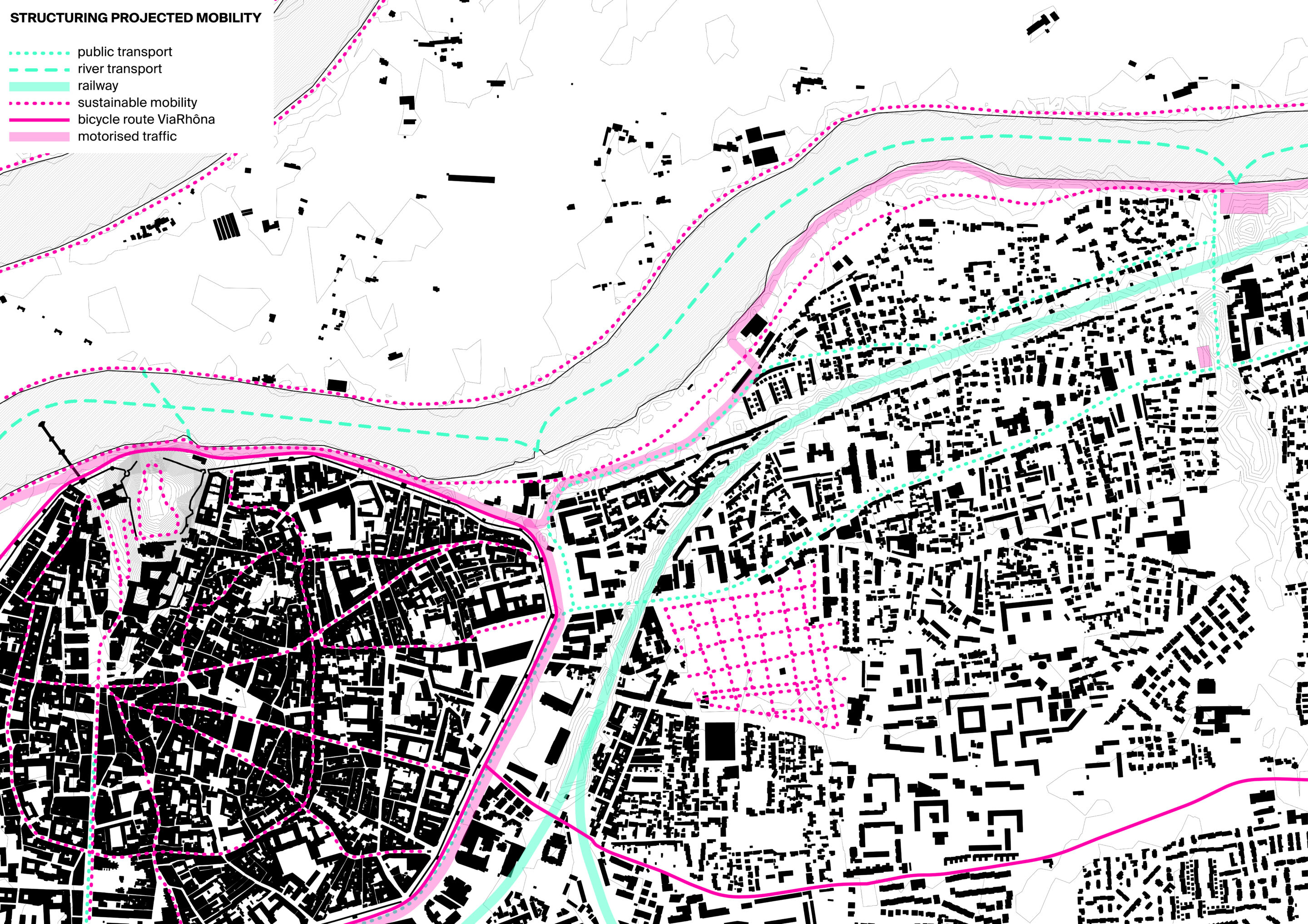
Analytical map "Mobility": the old city being mainly pedestrian, around the ramparts of Avignon are deployed several modes of transport which serve the various access doors. The rerouting of the departmental road, currently passing on the left bank of the Rhône, and the installation of a multi-story car park to the east of the city will open the study site to the river. The proposed perimeter is connected to the city center by a dedicated pedestrian and bicycle route, an optimized public transport line and a new river shuttle.
[map © LAST]
[map © LAST]
+ INFOS
INFOS X
Analytical map "Public amenities": the Palais des Papes, a 14th century monument classified as a UNESCO World Heritage Site, is a veritable fortress sitting on the impregnable Rocher des Doms. In connection with the Festival d’Avignon, the old town has a great number of small theaters, and its streets are full of local shops. Outside the ramparts, housing is the main occupation of the land, generating a built fabric lacking in diversity.
[map © LAST]
[map © LAST]
