Givors
Located in Givors, in the southernmost part of Greater Lyon, the 11-hectare site with a rich industrial past is still home to oil activities in the immediate vicinity of the Rhône. Positioned at the mouth of the Garon, this sector is a singular place of the Lyon metropolis, which constitutes a particularly strategic space to imagine new links between the city and its river. Simultaneously characterized by strong constraints and genuine landscape qualities, it is notably served by the railway station of Givors-Canal in the north and by a potential river stop in the south. In the context of the energy transition, the research aims to explore through the architectural project the multiple challenges and potentialities of the site reconversion into a mixed-use neighborhood. At the programmatic level, the visions are based on the prospective principle of a certain mix of housing and activities, with increased attention paid to the issue of housing in an urban environment. Relevant reflections on the implementation of a research center in the field of energy, and a diversity of public spaces considering the singular characteristics of the site, are also part of the approach.
+ INFOS
INFOS X
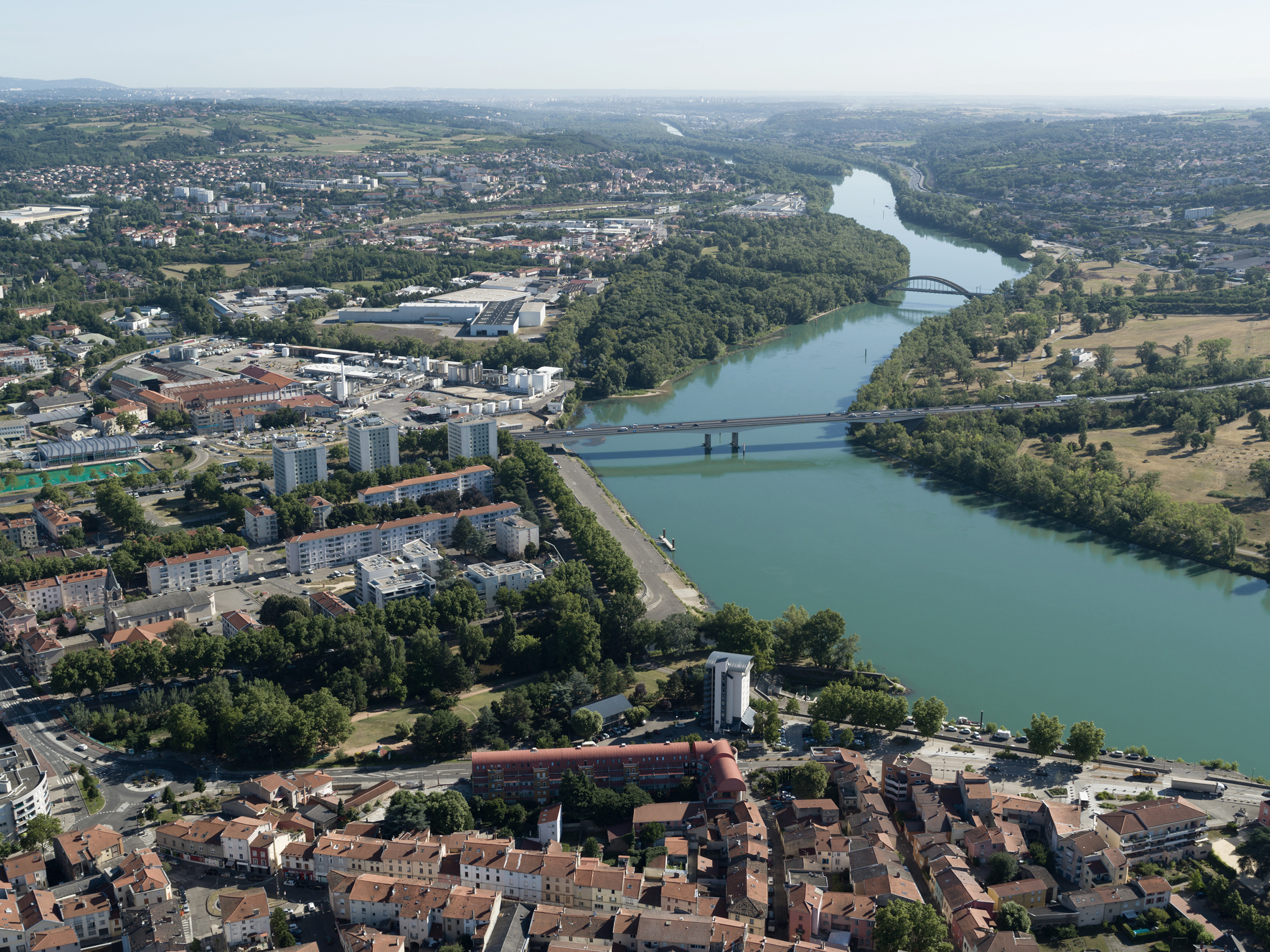
Aerial view of the Rhône in Givors: at the level of one of the river bends, the oil site - inaccessible to the public - is bordered by waterways on the east side (the Rhône and the Garon) and road infrastructures on the west (the motorway bridge and the Honoré Petetin Street).
[photo © Nicolas Sedlatchek]
[photo © Nicolas Sedlatchek]
+ INFOS
INFOS X
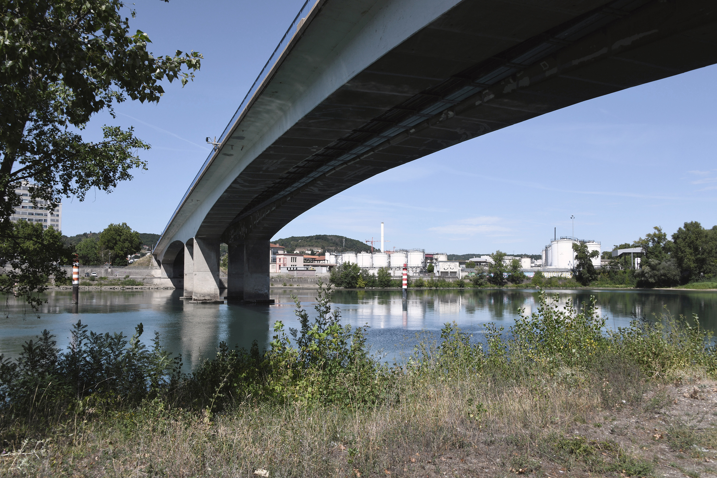
View of the study site in Givors: the 300-meter-long highway bridge, which became operational in 1970, contributes to the enclosed character of this part of the city.
[photo © LAST]
[photo © LAST]
+ INFOS
INFOS X
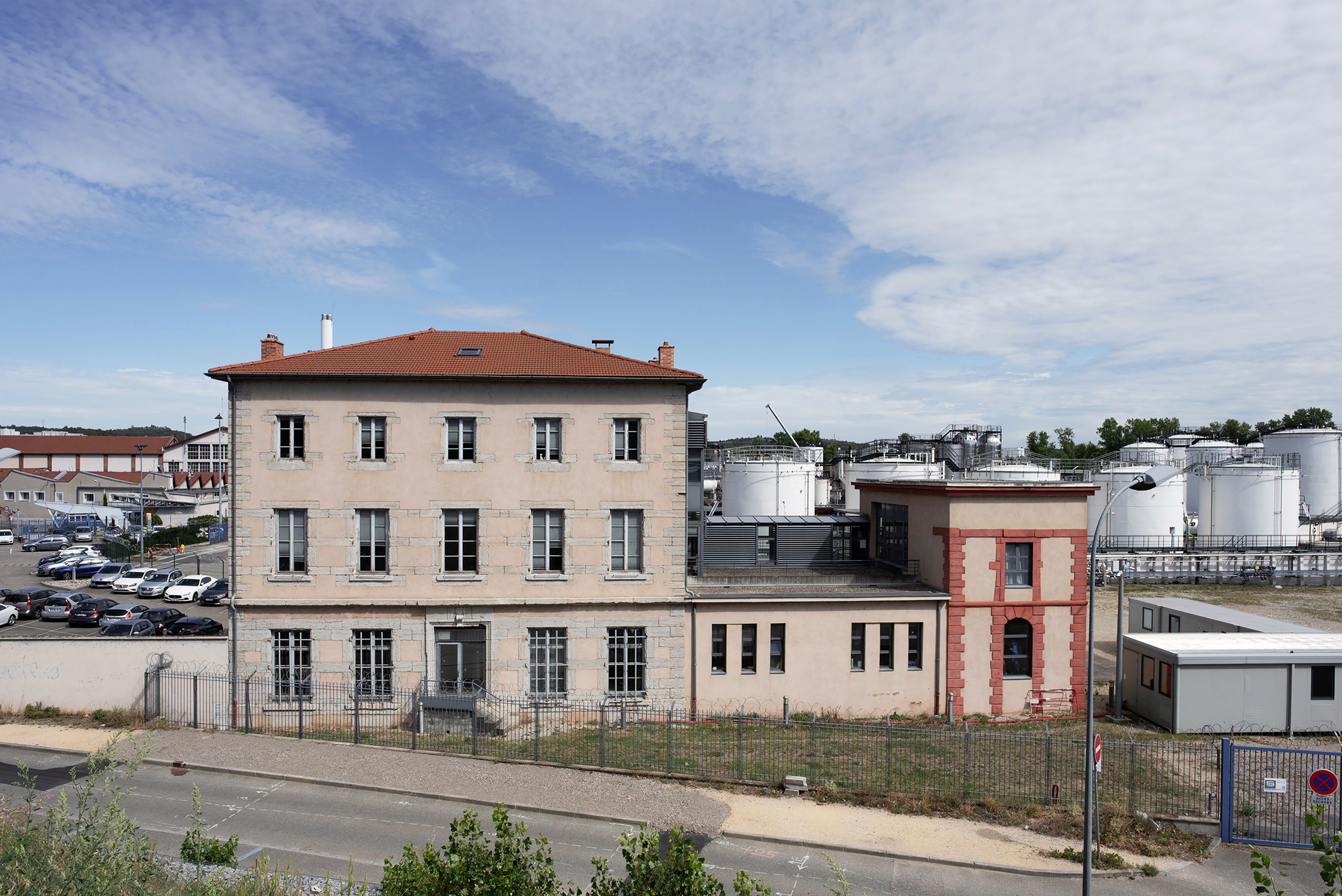
View of the study site in Givors: the former administration house of the Givors Canal, which supplied coal to many industries. Put into service in 1780 and measuring about 260 meters long and 180 meters wide, it could accommodate 250 boats.
[photo © LAST]
[photo © LAST]
+ INFOS
INFOS X
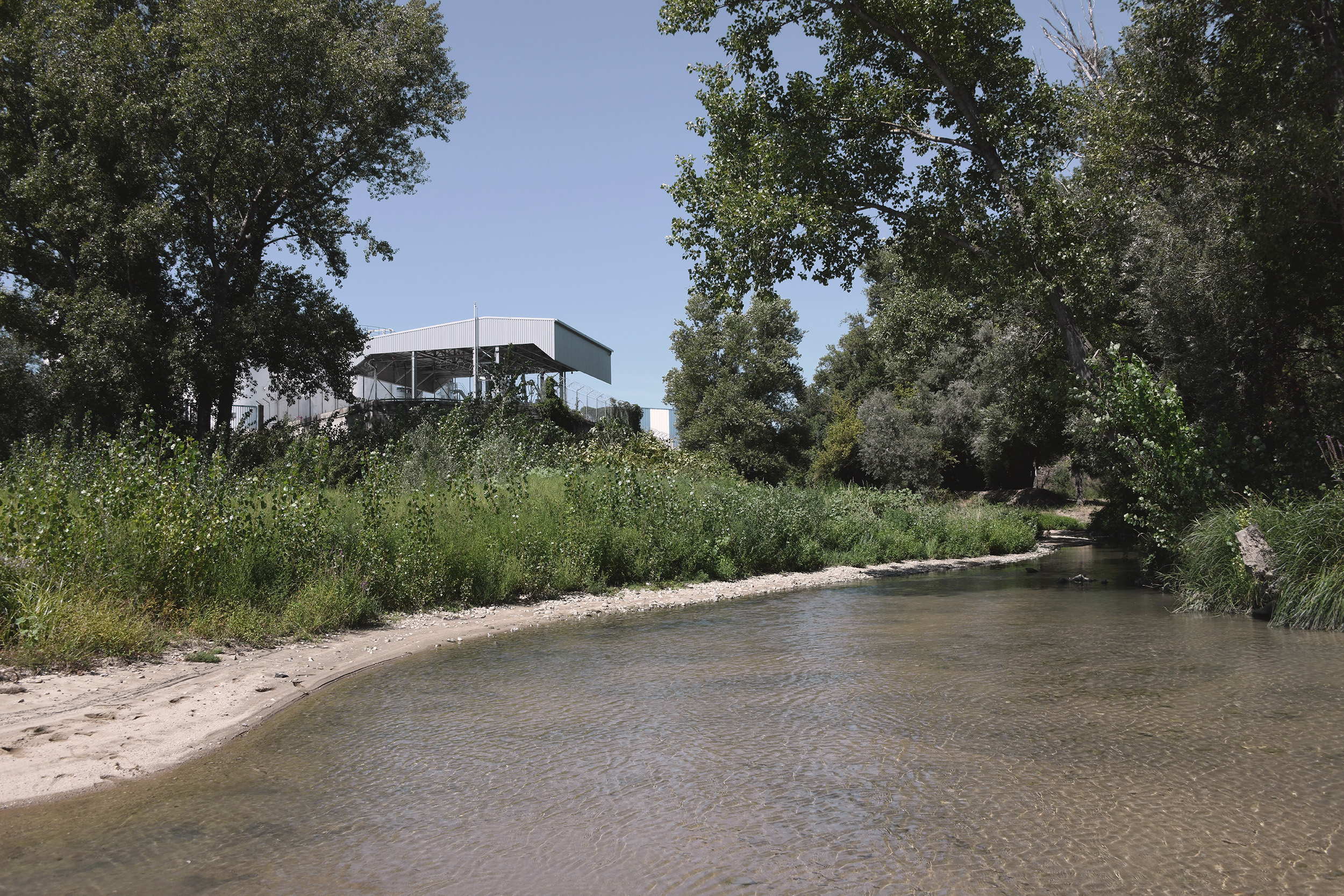
View of the study site in Givors: from the high and low quays on the right bank of the river, the site shows a face dedicated to the protection against the floods of the Rhône, enlivened by spontaneous riparian vegetation.
[photo © LAST]
[photo © LAST]
+ INFOS
INFOS X
View of the study site in Givors: the landscape and ecological qualities of the mouth of the Garon suggest new uses for the site.
[photo © LAST]
[photo © LAST]
+ INFOS
INFOS X
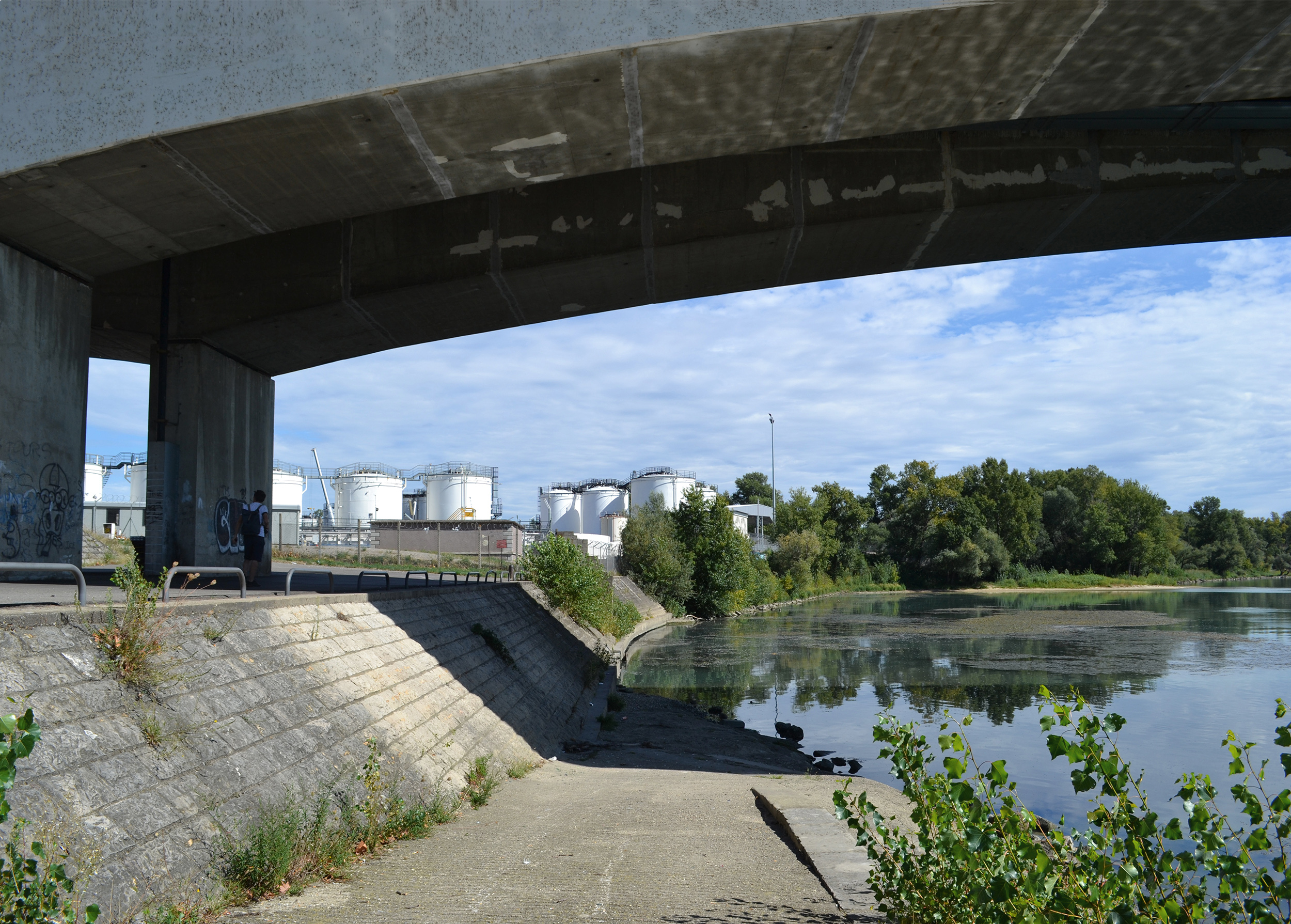
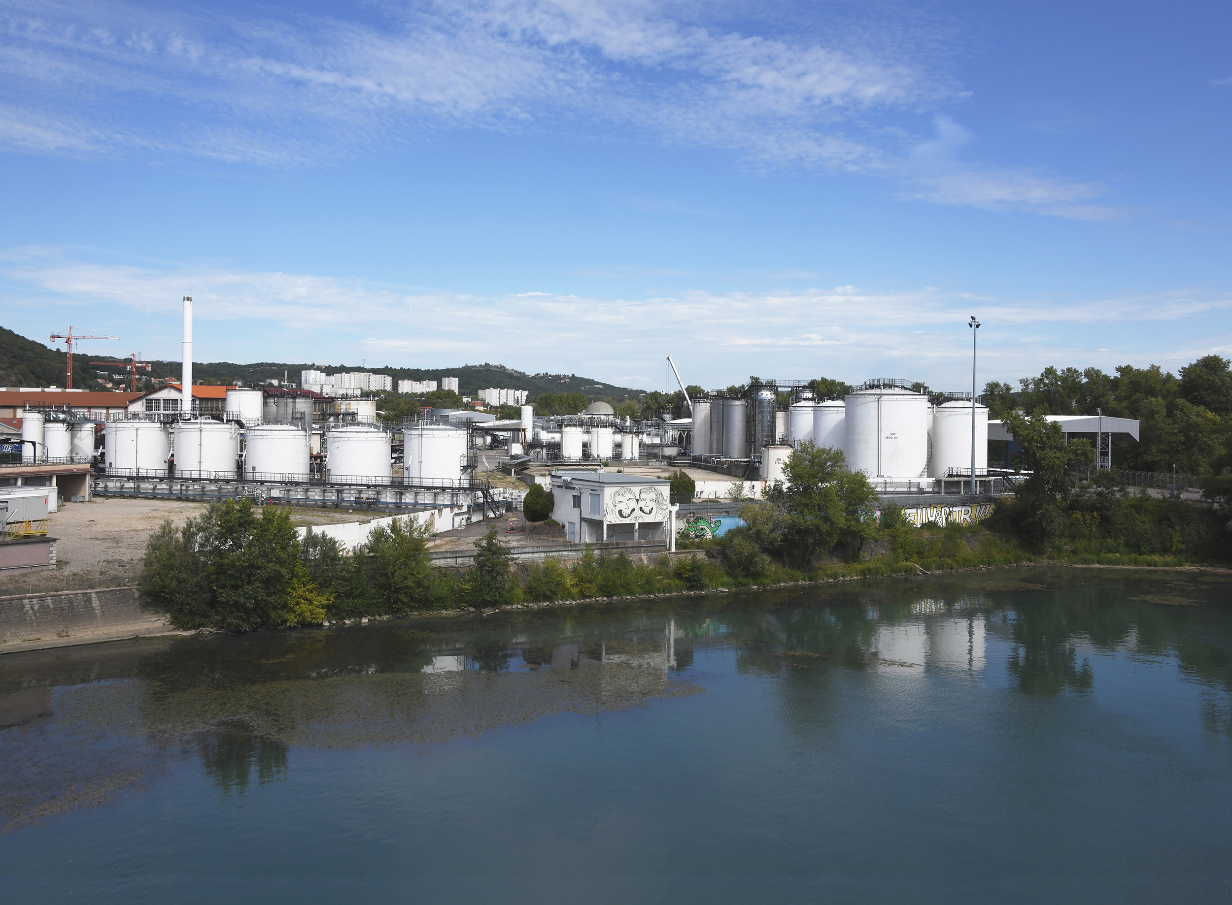
View of the study site in Givors: since the filling of the Canal basin in 1965, the site has maintained a certain amount of petroleum activity, dedicated to the creation of additives and special fuels.
[photo © LAST]
[photo © LAST]
+ INFOS
INFOS X
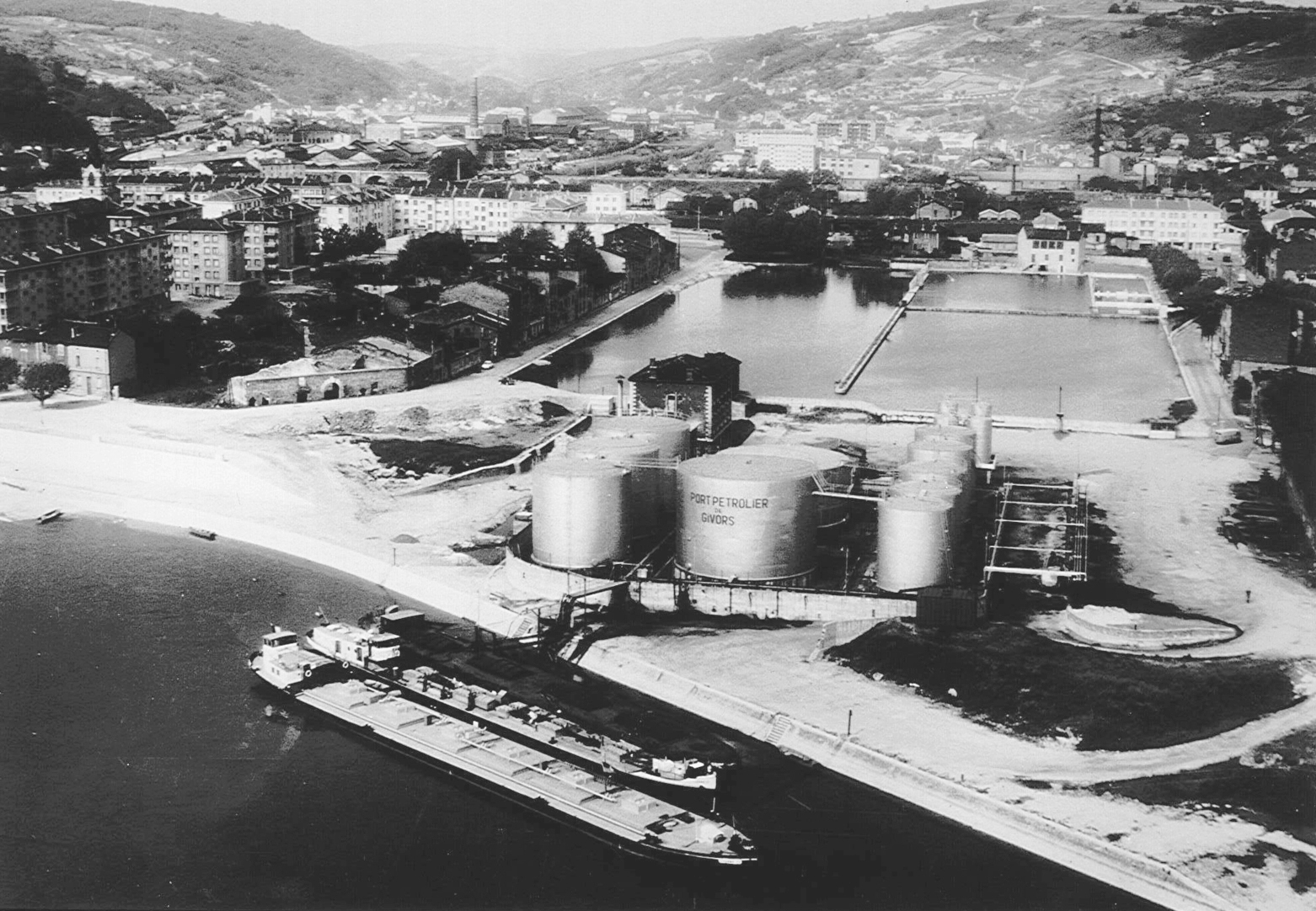
Aerial view of the oil port in 1961: adjacent to the basin and facing the Rhône, the activities of the oil port began in 1938, and continued until the 1970s.
[geneanet.org]
[geneanet.org]
+ INFOS
INFOS X
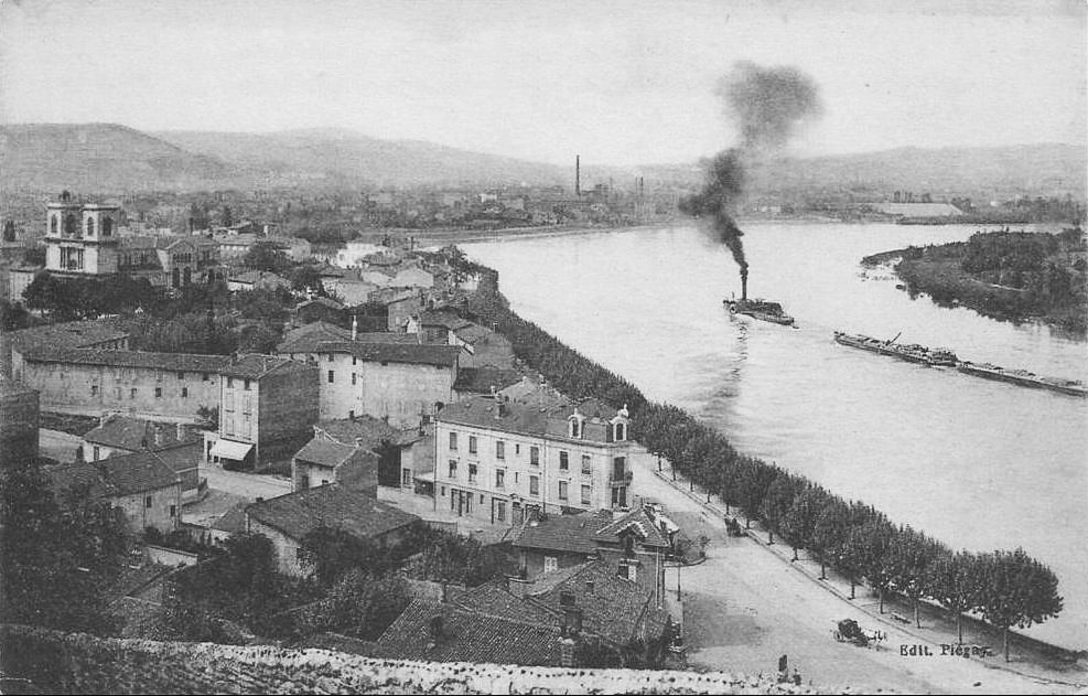
Givors and the Rhône, postcard from the beginning of the 20th century: the railroad, bringing coal more efficiently, gave rise to flourishing steel industry. The first blast furnace of the Etablissements Prenat was put into operation on the edge of the basin in 1839.
[geneanet.org]
[geneanet.org]
+ INFOS
INFOS X
Analytical map "Mobility": in the long term, the Givors mobility network will give priority to pedestrian and bicycle connections throughout the site, as well as a river shuttle on the Rhône, connecting Givors to Lyon and Vienne.
[map © LAST]
[map © LAST]

+ INFOS
INFOS X
Analytical map "Public amenities": while they are relatively numerous and distributed in the old town to the south, the northern part shows fewer public programs, especially concentrating the businesses along Jean Ligonnet Street, to the west of the study site.
[map © LAST]
[map © LAST]
